
How to get from West Point (airport) (Oregon) to Roseburg (Oregon)
Calculate route from West Point (airport) (Oregon, United States) to Roseburg (Oregon, United States).
The flight distance (as the crow flies) between West Point (airport) and Roseburg is 111.4 km.
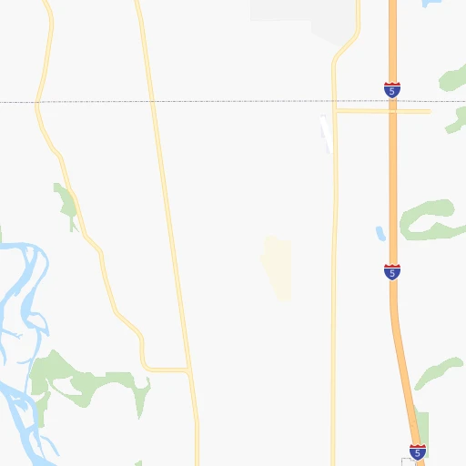
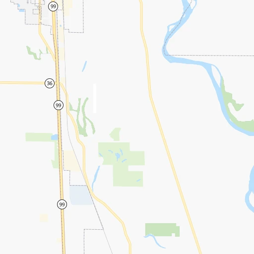
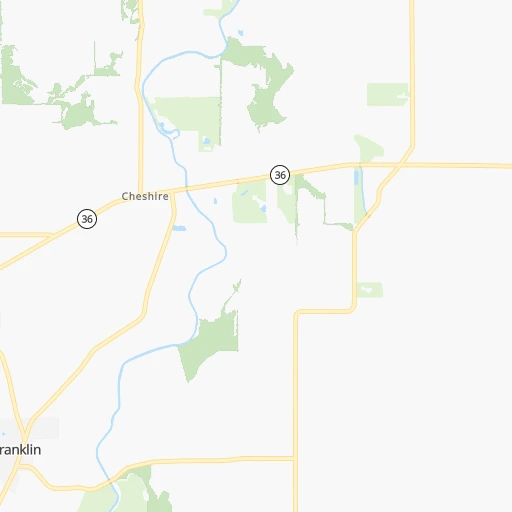
Roadmap (route) to go from West Point Airport to Roseburg detailed above, you can also see the course layout on the map.
While doing trip West Point (airport) - Roseburg by car, the calculated route ends at a distance , or more straight.
Distance and duration of the route between West Point (airport) and Roseburg
Calculation of distance and route from Roseburg to West Point (airport) :
111.4130.7 km2h31mn
Continue onto Coleman Road 0h2mn 1.3 kmTurn left onto Coburg Road North 0h8mn 6.4 kmTurn left onto West Van Duyn Street 0h0mn 335 mTurn right onto North Willamette Street 0h1mn 439 mTurn left onto East Pearl Street 0h1mn 1.0 kmTurn right 1h15mn 116.5 kmKeep right and drive toward North Roseburg 0h0mn 461 mTurn right onto Northwest Edenbower Boulevard 0h1mn 821 mTurn left onto Northwest Stewart Parkway 0h2mn 1.6 kmTurn right onto Northeast Stephens Street 0h2mn 1.7 kmTurn left onto Northeast Wright Avenue 0h0mn 82 mTurn left onto Northeast Winchester Street 0h0mn 1 mArrive at destination 0h0mn 0 m
Travel from West Point (airport) (Oregon) to a selection of major cities.
Distances from West Point Airport to biggest cities in Oregon
- West Linn,26,593 inhabitants.135 km
- Woodburn,25,173 inhabitants.106 km
- Forest Grove,23,897 inhabitants.147 km
- Newberg,22,780 inhabitants.123 km
- Wilsonville,22,729 inhabitants.125 km
- Roseburg,22,114 inhabitants.112 km
- Klamath Falls,21,399 inhabitants.243 km
- Ashland,20,861 inhabitants.225 km
- Milwaukie,20,830 inhabitants.143 km
- Bethany,20,646 inhabitants.152 km
- Lents,20,156 inhabitants.148 km
Other major cities in country :
- Charlotte [NC], 827,097 inhabitants. 3,706 km
- Seattle [WA], 684,451 inhabitants. 384 km
- Denver [CO], 682,545 inhabitants. 1,572 km
- El Paso [TX], 681,124 inhabitants. 2,000 km
- Detroit [MI], 677,116 inhabitants. 3,218 km
- Boston [MA], 667,137 inhabitants. 4,148 km
- Memphis [TN], 655,770 inhabitants. 2,978 km
- New South Memphis [TN], 641,608 inhabitants. 2,981 km
- Oklahoma City [OK], 631,346 inhabitants. 2,377 km
- Las Vegas [NV], 623,747 inhabitants. 1,117 km
- Baltimore [MD], 621,849 inhabitants. 3,844 km
- Washington, D.C. [DC], 601,723 inhabitants. 3,828 km
- Milwaukee [WI], 600,155 inhabitants. 2,814 km
- South Boston [MA], 571,281 inhabitants. 4,149 km
- Albuquerque [NM], 559,121 inhabitants. 1,729 km
- Tucson [AZ], 531,641 inhabitants. 1,700 km
- Nashville [TN], 530,852 inhabitants. 3,183 km
- Fresno [CA], 520,052 inhabitants. 875 km
- Sacramento [CA], 490,712 inhabitants. 639 km
- Kansas City [MO], 475,378 inhabitants. 2,423 km
Route from Roseburg to major cities (United States).
- Distance Roseburg New York City4,034 km
- Distance Roseburg Los Angeles1,112 km
- Distance Roseburg Chicago2,909 km
- Distance Roseburg Brooklyn4,041 km
- Distance Roseburg Houston2,897 km
- Distance Roseburg Queens4,048 km
- Distance Roseburg Philadelphia3,972 km
- Distance Roseburg Phoenix1,464 km
- Distance Roseburg Manhattan4,034 km
- Distance Roseburg San Antonio2,690 km
- Distance Roseburg San Diego1,288 km
- Distance Roseburg The Bronx4,039 km
- Distance Roseburg Dallas2,586 km
- Distance Roseburg San Jose666 km
- Distance Roseburg Austin2,684 km
- Distance Roseburg Jacksonville3,936 km
- Distance Roseburg San Francisco611 km
- Distance Roseburg Columbus3,346 km
- Distance Roseburg Fort Worth2,550 km
- Distance Roseburg Indianapolis3,098 km
Nearest cities to West Point (airport) :
- Portland, 632,309 inhabitants. 151 km
- Vancouver, 172,860 inhabitants. 163 km
- Salem, 164,549 inhabitants. 83 km
- Eugene, 163,460 inhabitants. 16 km
- Gresham, 110,553 inhabitants. 153 km
- Hillsboro, 102,347 inhabitants. 148 km
- Beaverton, 96,577 inhabitants. 145 km
- Yakima, 93,701 inhabitants. 334 km
- Bend, 87,014 inhabitants. 140 km
- Medford, 79,805 inhabitants. 209 km
- Springfield, 60,870 inhabitants. 17 km
- Lakewood, 59,829 inhabitants. 334 km
- Corvallis, 55,780 inhabitants. 44 km
- South Hill, 52,431 inhabitants. 333 km
- Albany, 52,175 inhabitants. 49 km
- Tigard, 51,253 inhabitants. 139 km
- Olympia, 50,302 inhabitants. 316 km
- Aloha, 49,425 inhabitants. 145 km
- Lacey, 46,409 inhabitants. 316 km
- Puyallup, 39,659 inhabitants. 338 km
- Lake Oswego, 38,496 inhabitants. 139 km
- Keizer, 37,895 inhabitants. 88 km
- Grants Pass, 37,088 inhabitants. 197 km
- Longview, 36,848 inhabitants. 216 km
- Oregon City, 35,831 inhabitants. 134 km
- Parkland, 35,803 inhabitants. 333 km
- McMinnville, 33,892 inhabitants. 113 km
- Redmond, 28,654 inhabitants. 150 km
- Spanaway, 27,227 inhabitants. 327 km
- Tualatin, 27,154 inhabitants. 134 km
- West Linn, 26,593 inhabitants. 135 km
- Woodburn, 25,173 inhabitants. 106 km
- Forest Grove, 23,897 inhabitants. 147 km
- Graham, 23,491 inhabitants. 323 km
- Newberg, 22,780 inhabitants. 123 km
- Wilsonville, 22,729 inhabitants. 125 km
- Roseburg, 22,114 inhabitants. 112 km
- Camas, 21,846 inhabitants. 163 km
- Klamath Falls, 21,399 inhabitants. 243 km
- Ashland, 20,861 inhabitants. 225 km
- Milwaukie, 20,830 inhabitants. 143 km
- Bethany, 20,646 inhabitants. 152 km
- Lents, 20,156 inhabitants. 148 km
- Hayesville, 19,936 inhabitants. 88 km
- Bonney Lake, 19,903 inhabitants. 338 km
- Salmon Creek, 19,686 inhabitants. 171 km
- Orchards, 19,556 inhabitants. 168 km
- Hazel Dell, 19,435 inhabitants. 167 km
- Battle Ground, 19,407 inhabitants. 181 km
- Sherwood, 19,283 inhabitants. 130 km
Location West Point (airport) (Oregon) :
| Country flag |  |
| Location | West Point (airport) |
| State | Oregon |
| County | Lane County |
| Country | United States |
| Country code / ISO 2 | US |
| Latitude | 44.1978500 |
| Longitude | -123.0555800 |
| Altitude | 115 meters |
| Time zone | America/Los_Angeles |
Location Roseburg (Oregon) :
| Country flag | |
| Location | Roseburg |
| State | Oregon |
| County | Douglas County |
| Country | United States |
| Country code / ISO 2 | US |
| Latitude | 43.2165000 |
| Longitude | -123.3417400 |
| Altitude | 147 meters |
| Time zone | America/Los_Angeles |


