

How to get from New Tazewell Municipal (airport) (Tennessee) to Fairfield (Ohio)
Calculate route from New Tazewell Municipal (airport) (Tennessee, United States) to Fairfield (Ohio, United States).
The flight distance (as the crow flies) between New Tazewell Municipal (airport) and Fairfield is 337.9 km.
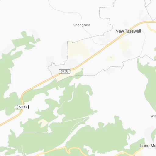
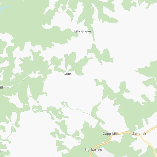
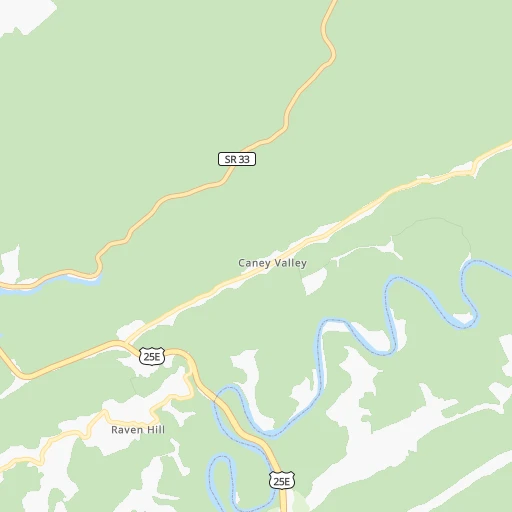
Roadmap (route) to go from New Tazewell Municipal Airport to Fairfield detailed above, you can also see the course layout on the map.
While doing trip New Tazewell Municipal (airport) - Fairfield by car, the calculated route ends at a distance , or more straight.
Distance and duration of the route between New Tazewell Municipal (airport) and Fairfield
Calculation of distance and route from Fairfield to New Tazewell Municipal (airport) :
337.9387.0 km5h44mn
Continue onto Airport Lane 0h2mn 781 mTurn right onto Blue Top Road 0h3mn 2.9 kmTurn right onto Blue Top Road 0h2mn 1.7 kmTurn right onto North Broad Street 0h0mn 187 mContinue onto North Broad Street 0h1mn 578 mContinue onto Appalachian Highway 0h18mn 22.1 kmTurn slight right onto 12th Street 0h16mn 18.2 kmTurn left onto Park Avenue 0h2mn 1.4 kmTurn left onto Riverview Avenue 0h16mn 18.3 kmTurn right onto KY 1304 0h10mn 9.8 kmTurn right onto KY 11, KY 1304 0h1mn 1.2 kmTurn left onto KY 1304 0h5mn 4.7 kmTurn right onto KY 1304, KY 1803 0h1mn 1.2 kmKeep left onto KY 1304 0h5mn 5.3 kmTurn right onto KY 229 0h20mn 20.4 kmTurn right onto South Main Street 0h3mn 3.8 kmTurn left onto Russell Dyche Memorial Highway 0h1mn 684 mKeep right 1h13mn 123.8 kmKeep right onto I 75 and take I 75 North toward Cincinnati 1h13mn 119.9 kmContinue onto Mill Creek Expressway and take I 75 North toward Dayton 0h4mn 5.0 kmKeep right and drive toward Hopple Street 0h0mn 462 mTurn sharp left onto Hopple Street Viaduct 0h0mn 345 mKeep right 0h0mn 43 mTurn slight right onto Colerain Avenue 0h1mn 668 mTurn left onto Monmouth Avenue 0h0mn 265 mTurn right onto Spring Grove Avenue 0h1mn 1.2 kmTurn left onto Colerain Avenue 0h1mn 1.1 kmTurn right onto Kirby Avenue 0h2mn 1.3 kmTurn right 0h0mn 90 mTurn slight right onto Ashtree Drive 0h21mn 19.7 kmTurn left onto Magie Avenue 0h0mn 96 mArrive at destination 0h0mn 0 m
Travel from New Tazewell Municipal (airport) (Ohio) to a selection of major cities.
Distances from New Tazewell Municipal Airport to biggest cities in Tennessee
- Spring Hill,36,055 inhabitants.312 km
- La Vergne,34,794 inhabitants.275 km
- Gallatin,34,334 inhabitants.259 km
- Cookeville,32,113 inhabitants.177 km
- Mount Juliet,31,540 inhabitants.267 km
- Brentwood Estates,31,279 inhabitants.293 km
- Lebanon,30,262 inhabitants.246 km
- Morristown,29,478 inhabitants.32 km
- Oak Ridge,29,302 inhabitants.78 km
- Maryville,28,464 inhabitants.82 km
- Bristol,26,666 inhabitants.124 km
- Farragut,21,919 inhabitants.80 km
- Shelbyville,21,317 inhabitants.281 km
- East Ridge,20,979 inhabitants.218 km
Other major cities in country :
- Charlotte [NC], 827,097 inhabitants. 278 km
- Seattle [WA], 684,451 inhabitants. 3,398 km
- Denver [CO], 682,545 inhabitants. 1,909 km
- El Paso [TX], 681,124 inhabitants. 2,171 km
- Detroit [MI], 677,116 inhabitants. 661 km
- Boston [MA], 667,137 inhabitants. 1,261 km
- Portland [OR], 632,309 inhabitants. 3,403 km
- Oklahoma City [OK], 631,346 inhabitants. 1,262 km
- Las Vegas [NV], 623,747 inhabitants. 2,821 km
- Baltimore [MD], 621,849 inhabitants. 689 km
- Washington, D.C. [DC], 601,723 inhabitants. 637 km
- Milwaukee [WI], 600,155 inhabitants. 826 km
- South Boston [MA], 571,281 inhabitants. 1,260 km
- Albuquerque [NM], 559,121 inhabitants. 2,087 km
- Tucson [AZ], 531,641 inhabitants. 2,550 km
- Fresno [CA], 520,052 inhabitants. 3,218 km
- Sacramento [CA], 490,712 inhabitants. 3,336 km
- Kansas City [MO], 475,378 inhabitants. 1,015 km
- Long Beach [CA], 474,140 inhabitants. 3,152 km
- Mesa [AZ], 471,825 inhabitants. 2,592 km
Route from Fairfield to major cities (United States).
- Distance Fairfield New York City912 km
- Distance Fairfield Los Angeles3,045 km
- Distance Fairfield Chicago382 km
- Distance Fairfield Brooklyn916 km
- Distance Fairfield Houston1,453 km
- Distance Fairfield Queens926 km
- Distance Fairfield Philadelphia808 km
- Distance Fairfield Phoenix2,540 km
- Distance Fairfield Manhattan916 km
- Distance Fairfield San Antonio1,687 km
- Distance Fairfield San Diego3,009 km
- Distance Fairfield The Bronx925 km
- Distance Fairfield Dallas1,320 km
- Distance Fairfield San Jose3,244 km
- Distance Fairfield Austin1,570 km
- Distance Fairfield Jacksonville1,038 km
- Distance Fairfield San Francisco3,276 km
- Distance Fairfield Fort Worth1,363 km
- Distance Fairfield Indianapolis145 km
- Distance Fairfield Charlotte564 km
Nearest cities to New Tazewell Municipal (airport) :
- Charlotte, 827,097 inhabitants. 278 km
- Atlanta, 463,878 inhabitants. 306 km
- Lexington-Fayette, 314,488 inhabitants. 199 km
- Cincinnati, 296,943 inhabitants. 314 km
- Meads, 288,649 inhabitants. 235 km
- Ironville, 288,649 inhabitants. 240 km
- Louisville, 243,639 inhabitants. 283 km
- Lexington, 225,366 inhabitants. 194 km
- Knoxville, 185,291 inhabitants. 60 km
- Chattanooga, 176,588 inhabitants. 220 km
- East Chattanooga, 154,024 inhabitants. 214 km
- Columbia, 133,803 inhabitants. 353 km
- Murfreesboro, 126,118 inhabitants. 263 km
- Athens, 116,714 inhabitants. 273 km
- Sandy Springs, 105,330 inhabitants. 287 km
- Roswell, 94,501 inhabitants. 276 km
- Asheville, 88,512 inhabitants. 127 km
- Concord, 87,696 inhabitants. 290 km
- Bloomington, 84,067 inhabitants. 403 km
- Johns Creek, 83,335 inhabitants. 272 km
- Gastonia, 74,543 inhabitants. 249 km
- Rock Hill, 71,548 inhabitants. 282 km
- Johnson City, 66,027 inhabitants. 108 km
- Greenville, 64,579 inhabitants. 203 km
- Alpharetta, 63,693 inhabitants. 268 km
- Bowling Green, 63,616 inhabitants. 266 km
- Hamilton, 62,407 inhabitants. 344 km
- Marietta, 59,067 inhabitants. 288 km
- Smyrna, 56,146 inhabitants. 294 km
- Kingsport, 53,014 inhabitants. 90 km
- Huntersville, 52,704 inhabitants. 269 km
- Brookhaven, 51,910 inhabitants. 293 km
- Stonecrest, 50,000 inhabitants. 305 km
- Charleston, 49,736 inhabitants. 275 km
- Dunwoody, 48,733 inhabitants. 283 km
- Huntington, 48,638 inhabitants. 244 km
- Jeffersonville, 46,960 inhabitants. 284 km
- Columbus, 46,690 inhabitants. 374 km
- Smyrna, 46,607 inhabitants. 270 km
- Kannapolis, 46,144 inhabitants. 284 km
- Cleveland, 43,898 inhabitants. 183 km
- Augusta, 43,459 inhabitants. 358 km
- Fairfield, 42,767 inhabitants. 338 km
- Covington, 40,997 inhabitants. 309 km
- Peachtree Corners, 40,978 inhabitants. 278 km
- North Atlanta, 40,456 inhabitants. 292 km
- Hickory, 40,374 inhabitants. 213 km
- Gainesville, 38,712 inhabitants. 236 km
- Spartanburg, 37,867 inhabitants. 219 km
- Milton, 37,547 inhabitants. 263 km
Location New Tazewell Municipal (airport) (Tennessee) :
| Country flag |  |
| Location | New Tazewell Municipal (airport) |
| State | Tennessee |
| County | Claiborne County |
| Country | United States |
| Country code / ISO 2 | US |
| Latitude | 36.4106200 |
| Longitude | -83.5554200 |
| Altitude | 357 meters |
| Time zone | America/New_York |
Location Fairfield (Ohio) :
| Country flag | |
| Location | Fairfield |
| State | Ohio |
| County | Butler County |
| Country | United States |
| Country code / ISO 2 | US |
| Latitude | 39.3458900 |
| Longitude | -84.5605000 |
| Altitude | 180 meters |
| Time zone | America/New_York |


