

How to get from Nīm Īstgāh-e Golshanābād (Isfahan) to Dorcheh Pīāz (Isfahan)
Calculate route from Nīm Īstgāh-e Golshanābād (Isfahan, Iran) to Dorcheh Pīāz (Isfahan, Iran).
The flight distance (as the crow flies) between Nīm Īstgāh-e Golshanābād and Dorcheh Pīāz is 150.2 km.
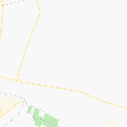
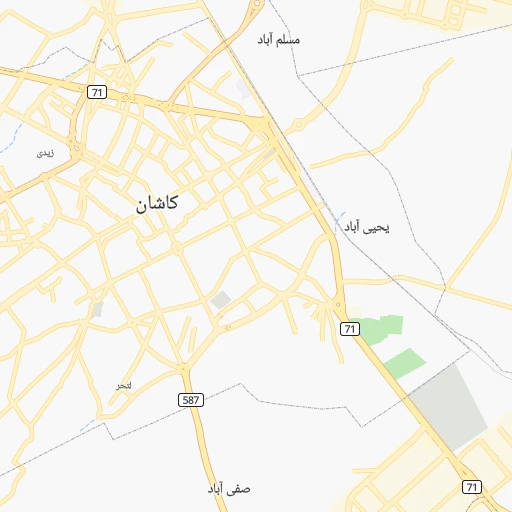
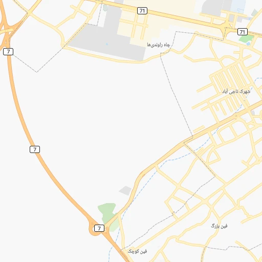
Roadmap (route) to go from Nīm Īstgāh-e Golshanābād to Dorcheh Pīāz detailed above, you can also see the course layout on the map.
While doing trip Nīm Īstgāh-e Golshanābād - Dorcheh Pīāz by car, the calculated route ends at a distance , or more straight.
Distance and duration of the route between Nīm Īstgāh-e Golshanābād and Dorcheh Pīāz
Calculation of distance and route from Dorcheh Pīāz to Nīm Īstgāh-e Golshanābād :
150.2213.0 km3h31mn
Continue onto کاشان - ابوزیدآباد 0h12mn 13.2 kmAt roundabout, take exit 2 onto کاشان - ابوزیدآباد 0h7mn 6.1 kmAt roundabout, take exit 1 onto کاشان - ابوزیدآباد 0h1mn 1.1 kmAt roundabout, take exit 2 onto بلوار بعثت 0h1mn 787 mAt roundabout, take exit 1 onto بلوار بعثت 0h1mn 507 mAt roundabout, take exit 1 onto بلوار بهشتی 0h0mn 488 mAt roundabout, take exit 2 onto بلوار بهشتی 0h2mn 2.0 kmAt roundabout, take exit 2 0h9mn 8.8 kmKeep left 0h1mn 930 mKeep right 0h0mn 123 mTurn slight right 0h5mn 3.8 kmTurn sharp left onto جاده نطنز - کاشان 0h5mn 5.6 kmKeep left 0h0mn 52 mTurn slight left 1h7mn 121.2 kmKeep right and take 65 toward اصفهان, شیراز 0h3mn 3.7 kmKeep left onto میمه - اصفهان 0h17mn 27.0 kmKeep right onto بزرگراه آزادگان 0h0mn 374 mAt roundabout, take exit 1 onto بزرگراه دانشگاه صنعتی اصفهان 0h4mn 5.3 kmKeep left onto آزادگان 0h1mn 496 mKeep left onto میدان معلم 0h0mn 69 mKeep right onto شریعتی شمالی 0h4mn 3.2 kmAt roundabout, take exit 2 onto مدرس 0h0mn 267 mTurn right onto ۱۹ 0h0mn 82 mTurn left onto ۱۹ 0h1mn 334 mTurn left 0h0mn 32 mTurn right onto ۱۲۴ 0h0mn 36 mKeep right onto ۱۲۴ 0h0mn 122 mTurn left 0h0mn 69 mTurn right 0h0mn 38 mKeep left 0h0mn 23 mTurn right onto شهدای مدافع حرم 0h0mn 126 mTurn left onto امیرکبیر 0h4mn 3.2 kmTurn right onto 62 0h0mn 13 mKeep right onto 62 0h0mn 303 mKeep left 0h0mn 58 mContinue onto امام خمینی 0h2mn 1.5 kmContinue onto امام خمینی 0h2mn 1.6 kmTurn left 0h0mn 196 mTurn right onto اکبر عابدی 0h0mn 84 mArrive at destination 0h0mn 0 m
Travel from Nīm Īstgāh-e Golshanābād (Isfahan) to a selection of major cities.
Distances from Nīm Īstgāh-e Golshanābād to biggest cities in Isfahan
Other major cities in country :
- Zanjan [36], 357,471 inhabitants. 410 km
- Bandar Abbas [11], 352,173 inhabitants. 880 km
- Sanandaj [16], 349,176 inhabitants. 443 km
- Qazvin [38], 333,635 inhabitants. 292 km
- Khorramshahr [15], 330,606 inhabitants. 504 km
- Khorramabad [23], 329,825 inhabitants. 300 km
- Sari [35], 255,396 inhabitants. 320 km
- Borujerd [23], 251,958 inhabitants. 259 km
- Qarchak [26], 251,834 inhabitants. 163 km
- Gorgan [37], 244,937 inhabitants. 414 km
- Sabzevar [42], 226,183 inhabitants. 612 km
- Neyshabur [42], 220,929 inhabitants. 706 km
- Nazarabad [44], 213,388 inhabitants. 237 km
- Bukan [01], 213,331 inhabitants. 563 km
- Sirjan [29], 207,645 inhabitants. 637 km
- Babol [35], 202,796 inhabitants. 305 km
- Amol [35], 199,382 inhabitants. 288 km
- Birjand [41], 196,982 inhabitants. 723 km
- Bojnurd [43], 192,041 inhabitants. 652 km
- Varamin [26], 179,603 inhabitants. 151 km
Route from Dorcheh Pīāz to major cities (Iran).
- Distance Dorcheh Pīāz Tehran343 km
- Distance Dorcheh Pīāz Mashhad842 km
- Distance Dorcheh Pīāz Karaj362 km
- Distance Dorcheh Pīāz Tabriz773 km
- Distance Dorcheh Pīāz Shiraz347 km
- Distance Dorcheh Pīāz Qom234 km
- Distance Dorcheh Pīāz Ahvaz307 km
- Distance Dorcheh Pīāz Pasragad Branch373 km
- Distance Dorcheh Pīāz Kahriz462 km
- Distance Dorcheh Pīāz Kermanshah458 km
- Distance Dorcheh Pīāz Rasht549 km
- Distance Dorcheh Pīāz Kerman585 km
- Distance Dorcheh Pīāz Orumiyeh806 km
- Distance Dorcheh Pīāz Zahedan953 km
- Distance Dorcheh Pīāz Hamadan372 km
- Distance Dorcheh Pīāz Azadshahr367 km
- Distance Dorcheh Pīāz Arak239 km
- Distance Dorcheh Pīāz Yazd277 km
- Distance Dorcheh Pīāz Ardabil693 km
- Distance Dorcheh Pīāz Abadan399 km
Nearest cities to Nīm Īstgāh-e Golshanābād :
- Tehran, 7,153,309 inhabitants. 193 km
- Isfahan, 1,547,164 inhabitants. 147 km
- Karaj, 1,448,075 inhabitants. 214 km
- Qom, 900,000 inhabitants. 97 km
- Ahvaz, 841,145 inhabitants. 399 km
- Azadshahr, 514,102 inhabitants. 289 km
- Arak, 503,647 inhabitants. 171 km
- Yazd, 477,905 inhabitants. 350 km
- Qazvin, 333,635 inhabitants. 292 km
- Khomeyni Shahr, 277,334 inhabitants. 143 km
- Sari, 255,396 inhabitants. 320 km
- Borujerd, 251,958 inhabitants. 259 km
- Qarchak, 251,834 inhabitants. 163 km
- Gorgan, 244,937 inhabitants. 414 km
- Najafabad, 223,450 inhabitants. 149 km
- Nazarabad, 213,388 inhabitants. 237 km
- Babol, 202,796 inhabitants. 305 km
- Amol, 199,382 inhabitants. 288 km
- Varamin, 179,603 inhabitants. 151 km
- Malayer, 176,573 inhabitants. 254 km
- Saveh, 175,533 inhabitants. 161 km
- Shahr-e Kord, 129,153 inhabitants. 194 km
- Semnan, 124,826 inhabitants. 246 km
- Masjed Soleyman, 111,510 inhabitants. 308 km
- Shahreza, 100,790 inhabitants. 217 km
- Behshahr, 93,500 inhabitants. 354 km
- Aligudarz, 91,041 inhabitants. 183 km
- Shahre Jadide Andisheh, 80,000 inhabitants. 197 km
- Shushtar, 77,507 inhabitants. 330 km
- Khomeyn, 77,425 inhabitants. 141 km
- Alvand, 74,889 inhabitants. 340 km
- Takestan, 71,499 inhabitants. 289 km
- Abhar, 69,889 inhabitants. 323 km
- Chalus, 69,638 inhabitants. 299 km
- Damghan, 67,694 inhabitants. 353 km
- Robat Karim, 62,753 inhabitants. 174 km
- Shahriar, 58,849 inhabitants. 194 km
- Ardakan, 58,834 inhabitants. 295 km
- Abadeh, 56,988 inhabitants. 329 km
- Malard, 56,745 inhabitants. 196 km
- Abyek, 55,128 inhabitants. 251 km
- Pishva, 53,856 inhabitants. 150 km
- Borujen, 52,654 inhabitants. 224 km
- Meybod, 51,874 inhabitants. 299 km
- Khorramdarreh, 50,528 inhabitants. 329 km
- Falavarjan, 49,843 inhabitants. 157 km
- Istgah-e Rah Ahan-e Garmsar, 49,491 inhabitants. 157 km
- Rehnan, 49,143 inhabitants. 143 km
- Neka, 48,847 inhabitants. 338 km
- Babolsar, 48,051 inhabitants. 321 km
Location Nīm Īstgāh-e Golshanābād (Isfahan) :
| Country flag |  |
| Location | Nīm Īstgāh-e Golshanābād |
| State | Isfahan |
| County | |
| Country | Iran |
| Country code / ISO 2 | IR |
| Latitude | 33.9666700 |
| Longitude | 51.5500000 |
| Altitude | 0 meters |
| Time zone | Asia/Tehran |
Location Dorcheh Pīāz (Isfahan) :
| Country flag | |
| Location | Dorcheh Pīāz |
| State | Isfahan |
| County | |
| Country | Iran |
| Country code / ISO 2 | IR |
| Latitude | 32.6152800 |
| Longitude | 51.5555600 |
| Altitude | 0 meters |
| Time zone | Asia/Tehran |