

How to get from Madār (Rajasthan) to Gangānagar (Rajasthan)
Calculate route from Madār (Rajasthan, India) to Gangānagar (Rajasthan, India).
The flight distance (as the crow flies) between Madār and Gangānagar is 392.2 km.
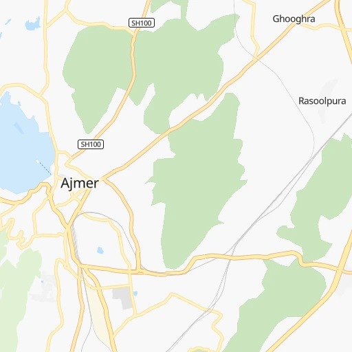
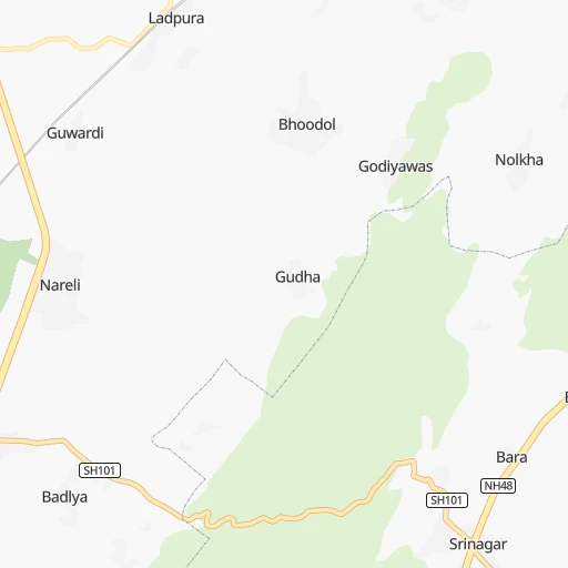
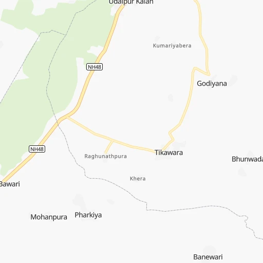
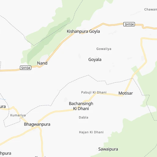
Roadmap (route) to go from Madār to Gangānagar detailed above, you can also see the course layout on the map.
While doing trip Madār - Gangānagar by car, the calculated route ends at a distance , or more straight.
Distance and duration of the route between Madār and Gangānagar
Calculation of distance and route from Gangānagar to Madār :
392.2467.1 km7h1mn
Continue 0h2mn 833 mTurn sharp right 0h0mn 40 mTurn right 0h0mn 81 mTurn sharp left 0h0mn 155 mKeep right 0h0mn 47 mTurn left 0h2mn 1.0 kmTurn right onto Shreenagar Road 0h1mn 278 mKeep right onto Shreenagar Road 0h2mn 2.1 kmAt roundabout, take exit 2 onto Shreenagar Road 0h3mn 3.2 kmAt roundabout, take exit 1 0h0mn 147 mTurn right 0h0mn 51 mTurn right 0h1mn 452 mTurn slight left onto NH58 0h5mn 6.3 kmKeep right 0h3mn 2.2 kmTurn right onto Pushkar Merta Highway 0h1mn 666 mTurn left 0h0mn 124 mTurn left 0h5mn 5.6 kmTurn slight right onto Pushkar Merta Highway 0h7mn 8.0 kmTurn right onto SH60 0h10mn 10.7 kmTurn right onto SH21A, SH59, SH60 0h1mn 611 mKeep left onto SH60 0h11mn 12.5 kmTurn right onto SH60 0h16mn 17.5 kmTurn sharp right onto NH458 0h0mn 574 mTurn left onto NH458 0h25mn 28.7 kmTurn right onto NH458 0h1mn 1.2 kmTurn right onto NH458 0h15mn 17.7 kmTurn sharp left onto SH60, 59 0h0mn 470 mTurn right onto SH59 1h31mn 33.8 kmContinue onto NH58 0h7mn 8.0 kmKeep left 0h2mn 2.2 kmKeep left 0h0mn 91 mContinue 0h1mn 626 mTurn slight right 0h0mn 106 mTurn left 0h0mn 100 mTurn right 0h0mn 44 mTurn left 0h0mn 172 mTurn right 0h0mn 70 mTurn left 0h0mn 14 mTurn sharp right 0h11mn 9.6 kmTurn left onto SH20A 0h15mn 16.2 kmTurn left onto SH20 0h1mn 1.2 kmTurn right onto SH93 0h22mn 24.5 kmTurn right onto SH93 0h19mn 20.8 kmTurn left 0h0mn 5 mKeep right 0h0mn 37 mTurn left 0h1mn 901 mTurn left 0h0mn 128 mTurn right 0h0mn 40 mTurn left 0h1mn 750 mTurn right onto SH93 1h32mn 35.3 kmTurn left onto SH6A 0h11mn 12.2 kmAt roundabout, take exit 2 onto SH6A 0h0mn 247 mAt roundabout, take exit 1 onto SH6A 0h7mn 7.8 kmTurn right onto NH62 1h26mn 100.1 kmAt roundabout, take exit 1 onto NH62 0h4mn 4.2 kmAt roundabout, take exit 2 onto NH62 1h50mn 58.2 kmTurn left 0h7mn 7.4 kmAt roundabout, take exit 1 0h1mn 942 mTurn sharp right 0h0mn 87 mArrive at destination 0h0mn 0 m
Travel from Madār (Rajasthan) to a selection of major cities.
Distances from Madār to biggest cities in Rajasthan
- Chittaurgarh,106,710 inhabitants.175 km
- Churu,103,533 inhabitants.207 km
- Dhaulpur,102,462 inhabitants.319 km
- Bundi,98,569 inhabitants.149 km
- Nagaur,96,847 inhabitants.125 km
- Hindaun,95,593 inhabitants.236 km
- Makrana,93,904 inhabitants.65 km
- Banswara,93,648 inhabitants.326 km
- Barmer,89,487 inhabitants.339 km
- Baran,87,478 inhabitants.238 km
- Sardarshahr,86,672 inhabitants.221 km
- Fatehpur,83,170 inhabitants.172 km
- Karauli,73,717 inhabitants.233 km
- Dausa,73,034 inhabitants.171 km
- Balotra,68,120 inhabitants.255 km
- Jaisalmer,67,604 inhabitants.380 km
- Ratangarh,66,625 inhabitants.180 km
- Rajsamand,63,414 inhabitants.175 km
- Suratgarh,63,153 inhabitants.327 km
- Ladnun,60,490 inhabitants.135 km
Other major cities in country :
- Gorakhpur [10], 1,324,570 inhabitants. 346 km
- Nashik [16], 1,289,497 inhabitants. 726 km
- Pimpri [16], 1,284,606 inhabitants. 878 km
- Kalyan [16], 1,262,255 inhabitants. 819 km
- Thane [16], 1,261,517 inhabitants. 828 km
- Meerut [36], 1,223,184 inhabitants. 408 km
- Nowrangapur [21], 1,220,946 inhabitants. 1,139 km
- Faridabad [10], 1,220,229 inhabitants. 338 km
- Ghaziabad [36], 1,199,191 inhabitants. 366 km
- Dombivli [16], 1,193,000 inhabitants. 823 km
- Rajkot [09], 1,177,362 inhabitants. 610 km
- Varanasi [36], 1,164,404 inhabitants. 843 km
- Amritsar [23], 1,092,450 inhabitants. 574 km
- Allahabad [36], 1,073,438 inhabitants. 725 km
- Visakhapatnam [02], 1,063,178 inhabitants. 1,313 km
- Teni [25], 1,034,724 inhabitants. 1,855 km
- Jabalpur [35], 1,030,168 inhabitants. 646 km
- Haora [28], 1,027,672 inhabitants. 1,446 km
- Aurangabad [16], 1,016,441 inhabitants. 736 km
- Shivaji Nagar [16], 1,000,000 inhabitants. 887 km
Route from Gangānagar to major cities (India).
- Distance Gangānagar Mumbai1,212 km
- Distance Gangānagar Delhi355 km
- Distance Gangānagar Bengaluru1,925 km
- Distance Gangānagar Kolkata1,660 km
- Distance Gangānagar Chennai1,986 km
- Distance Gangānagar Ahmedabad778 km
- Distance Gangānagar Hyderabad1,471 km
- Distance Gangānagar Pune1,269 km
- Distance Gangānagar Surat977 km
- Distance Gangānagar Kanpur742 km
- Distance Gangānagar Navi Mumbai1,215 km
- Distance Gangānagar Lucknow771 km
- Distance Gangānagar Nagpur1,108 km
- Distance Gangānagar Indore825 km
- Distance Gangānagar Patna1,209 km
- Distance Gangānagar Bhopal821 km
- Distance Gangānagar Ludhiana220 km
- Distance Gangānagar Tirunelveli2,392 km
- Distance Gangānagar Agra507 km
- Distance Gangānagar Vadodara851 km
Nearest cities to Madār :
- Delhi, 10,927,986 inhabitants. 350 km
- Jaipur, 2,711,758 inhabitants. 121 km
- Gorakhpur, 1,324,570 inhabitants. 346 km
- Faridabad, 1,220,229 inhabitants. 338 km
- Ghaziabad, 1,199,191 inhabitants. 366 km
- Jodhpur, 921,476 inhabitants. 169 km
- Kota, 763,088 inhabitants. 183 km
- Bikaner, 576,015 inhabitants. 220 km
- Ajmer, 517,911 inhabitants. 5 km
- Karol Bagh, 505,241 inhabitants. 347 km
- Udaipur, 422,784 inhabitants. 231 km
- Mathura, 330,511 inhabitants. 318 km
- Bhilwara, 326,431 inhabitants. 124 km
- New Delhi, 317,797 inhabitants. 348 km
- Rohtak, 317,245 inhabitants. 329 km
- Hisar, 296,436 inhabitants. 316 km
- Noida, 293,908 inhabitants. 351 km
- Greater Noida, 293,908 inhabitants. 361 km
- Panipat, 292,808 inhabitants. 395 km
- Alwar, 283,228 inhabitants. 228 km
- Sonipat, 250,521 inhabitants. 363 km
- Bharatpur, 229,384 inhabitants. 291 km
- Pali, 210,103 inhabitants. 157 km
- Sikar, 199,932 inhabitants. 135 km
- Gurgaon, 197,340 inhabitants. 320 km
- Nangloi Jat, 194,363 inhabitants. 341 km
- Bhiwani, 190,855 inhabitants. 296 km
- Sujangarh, 183,808 inhabitants. 139 km
- Loni, 164,810 inhabitants. 362 km
- Shivpuri, 164,215 inhabitants. 319 km
- Jind, 161,260 inhabitants. 355 km
- Guna, 153,689 inhabitants. 332 km
- Bahadurgarh, 153,613 inhabitants. 333 km
- Tonk, 151,331 inhabitants. 115 km
- Kishangarh, 131,749 inhabitants. 22 km
- Beawar, 130,777 inhabitants. 55 km
- Mandsaur, 124,988 inhabitants. 269 km
- Palanpur, 123,294 inhabitants. 341 km
- Palwal, 121,965 inhabitants. 321 km
- Gangapur, 120,115 inhabitants. 202 km
- Deoli, 120,000 inhabitants. 338 km
- Patan, 117,863 inhabitants. 389 km
- Jhunjhunun, 113,193 inhabitants. 198 km
- Rewari, 112,079 inhabitants. 272 km
- Sawai Madhopur, 108,612 inhabitants. 173 km
- Chittaurgarh, 106,710 inhabitants. 175 km
- Churu, 103,533 inhabitants. 207 km
- Bundi, 98,569 inhabitants. 149 km
- Shamli, 97,966 inhabitants. 421 km
- Nagaur, 96,847 inhabitants. 125 km
Location Madār (Rajasthan) :
| Country flag |  |
| Location | Madār |
| State | Rajasthan |
| County | Ajmer |
| Country | India |
| Country code / ISO 2 | IN |
| Latitude | 26.4643000 |
| Longitude | 74.6879000 |
| Altitude | 0 meters |
| Time zone | Asia/Kolkata |
Location Gangānagar (Rajasthan) :
| Country flag | |
| Location | Gangānagar |
| State | Rajasthan |
| County | Gangānagar |
| Country | India |
| Country code / ISO 2 | IN |
| Latitude | 29.9200900 |
| Longitude | 73.8749600 |
| Altitude | 0 meters |
| Time zone | Asia/Kolkata |


